Satellite images have become a crucial tool in monitoring deforestation across the globe. By capturing high-resolution photographs of forested areas, these images enable researchers and conservationists to detect changes in land use over time. This technology provides timely information about deforestation trends, allowing for more effective conservation strategies and policy-making.
Through satellite imagery, it is possible to analyse large areas quickly and efficiently, identifying illegal logging and land clearing activities that may go unnoticed from the ground. This approach not only enhances transparency but also promotes accountability among those involved in land management. The combination of satellite technology and data analytics offers a powerful means of safeguarding forests and ensuring sustainable practices.
Now, as environmental concerns grow, understanding how satellite imagery aids in these efforts is more important than ever. This innovative method not only highlights the extent of deforestation but also paves the way for global initiatives aimed at preserving vital ecosystems.
Understanding Deforestation
Deforestation is a significant environmental issue that results from various activities, impacting biodiversity and disrupting forest ecosystems. The complexities of this problem warrant careful examination of its primary causes and consequences on living organisms and natural processes.
Causes of Deforestation
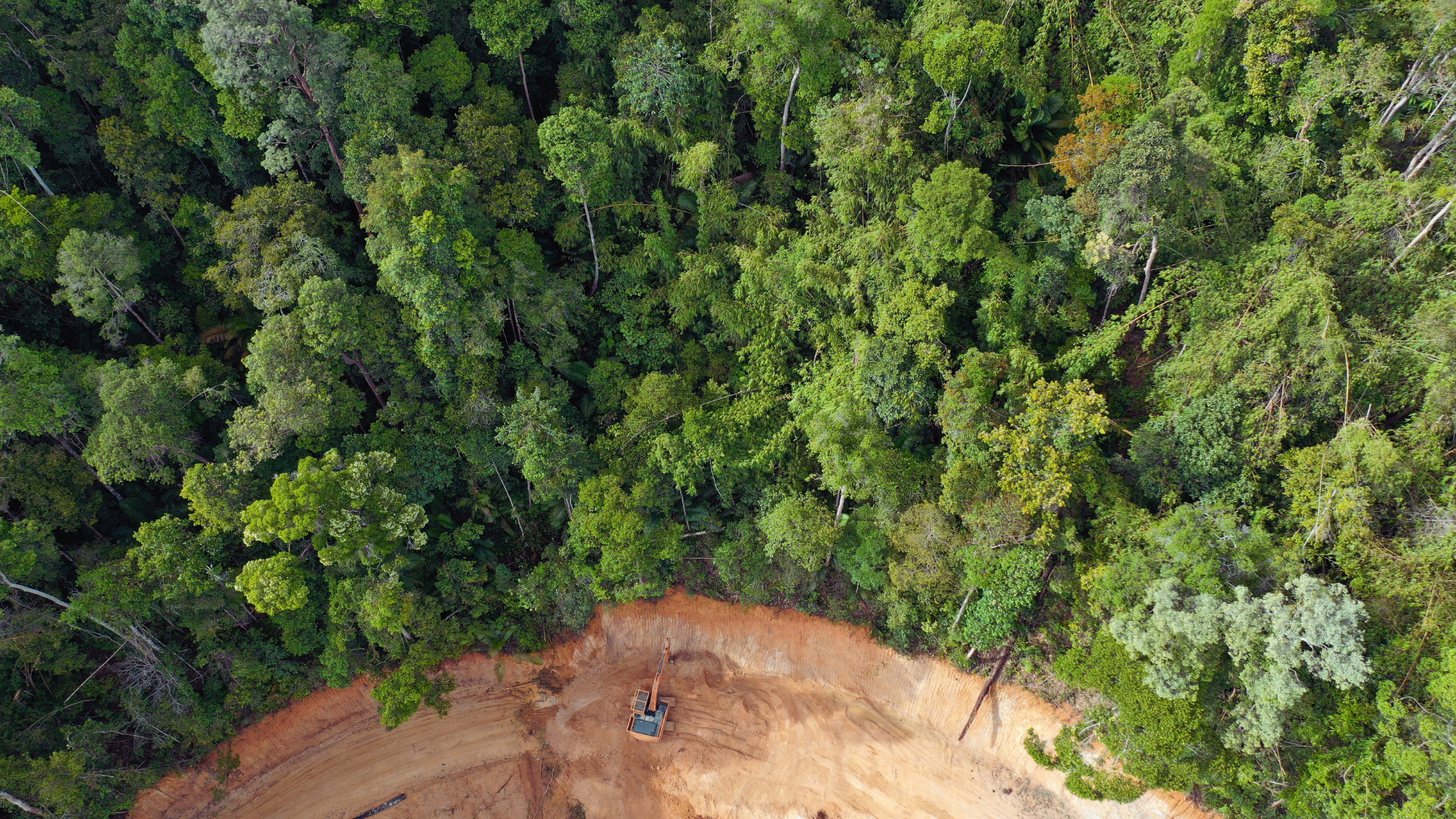
Deforestation stems from numerous factors, including agriculture, logging, and urbanisation. Expansion of agricultural land to meet global food demands drives significant forest loss. Many farmers clear vast tracts of forest for crops or livestock, often using slash-and-burn techniques.
Logging operations, both legal and illegal, contribute heavily as timber and paper industries demand large quantities of wood. Urbanisation also plays a role, with growing populations requiring space for infrastructure.
Additional factors include mining and infrastructure development. These activities disrupt habitats, leading to both direct deforestation and fragmentation of remaining forest areas.
Effects on Biodiversity
The loss of forests poses a serious threat to biodiversity. Approximately 80% of terrestrial species reside in forests, making them critical for the survival of countless plants and animals. Deforestation leads to habitat destruction, resulting in diminished populations and the potential extinction of various species.
Fragmentation often isolates these species, reducing genetic diversity and resilience. As ecosystems become more vulnerable, entire food webs can collapse. This results in a cascade of effects throughout the ecosystem, disrupting interactions between flora and fauna.
The conservation status of many species rapidly declines in deforested areas, impacting not just wildlife but also human communities that rely on these resources for sustenance and cultural practices.
Impact on Forest Ecosystems
Forest ecosystems provide essential services, including carbon sequestration, water regulation, and soil stability. Deforestation disrupts these functions, leading to increased greenhouse gas emissions and climate change.
As trees are removed, carbon stored in foliage and soil is released back into the atmosphere, exacerbating global warming. The alteration of water cycles results in changes in precipitation patterns, which can lead to droughts or floods.
Soil erosion increases without tree cover, degrading land quality. This may result in lower agricultural productivity and further compounding issues related to food security. Restoring these ecosystems is critical for maintaining ecological balance and human livelihoods.
Satellite Imagery in Deforestation Monitoring
Satellite imagery plays a crucial role in monitoring deforestation across the globe. It provides vital data for assessing changes in forest cover and understanding the impacts of human activity on ecosystems.
Principles of Remote Sensing
Remote sensing uses satellite or aerial imaging technology to collect data about the Earth’s surface without physical contact. This process utilises electromagnetic radiation to capture information about various surfaces, including forests.
Satellite sensors detect different wavelengths reflected from the Earth, particularly in the visible and infrared spectrum. By analysing these wavelengths, researchers can distinguish between healthy vegetation and deforested areas.
Key techniques include:
- Multispectral imaging: Captures data across multiple wavelengths for detailed analysis.
- Hyperspectral imaging: Offers even more detailed spectral information, aiding in species identification.
These techniques allow for continuous monitoring and provide a valuable timeframe for analysing changes in deforestation rates.
Types of Satellite Images
Various types of satellite images are employed in deforestation monitoring. Each type caters to specific requirements, offering unique advantages for analysis.
- Optical Imagery: Utilises visible light to capture images. It is commonly used for mapping and assessing deforestation as it provides clear visuals of forest cover.
- Radar Imagery: Utilises radio waves to penetrate cloud cover and capture data regardless of weather conditions. This feature makes radar imagery particularly valuable for consistent monitoring.
- LiDAR (Light Detection and Ranging): Uses laser pulses to measure distances. This method creates detailed 3D models of forest structures, aiding in biomass estimation and canopy height measurement.
- Daily and Seasonal Revisit Satellites: Some satellites, like Sentinel-2 or Landsat, provide images at regular intervals, allowing for time-sensitive assessments.
These diverse satellite imaging types support the effective tracking of deforestation and contribute significantly to environmental management strategies.
Applications of Satellite Data
Satellite data plays a crucial role in environmental monitoring, particularly in tracking changes in forest areas. The applications of this technology are diverse, ranging from detecting forest degradation to monitoring illicit activities such as illegal logging. Each application provides important insights for conservation efforts.
Detecting Forest Degradation
Satellite imagery allows for the detailed assessment of forest health over time. It enables researchers to identify subtle changes indicative of forest degradation.
Key indicators include:
- Leaf area index (LAI): A measure of foliage density.
- Canopy cover: Changes in the percentage of tree cover.
- Spectral signatures: Differences in light reflectance can signal stress or loss in biodiversity.
These factors contribute to understanding how environmental stressors like climate change or human activities affect forest ecosystems.
Monitoring Tropical Forests
Tropical forests, often dense and challenging to survey on foot, benefit significantly from satellite technology. High-resolution images enable the monitoring of these ecosystems’ intricate structures.
Devices equipped with multispectral sensors provide data on:
- Deforestation rates: Tracking loss of forested areas.
- Fragmentation: Understanding how habitats are split into smaller sections.
- Health assessments: Identifying areas that may be threatened by logging or mining activities.
This data supports conservation strategies and informs policy decisions.
Identifying Illegal Activities
Satellite images are pivotal in detecting illegal activities such as unauthorised logging and mining operations. By analysing changes in forest cover and land use, authorities can pinpoint areas of concern.
Detection methods include:
- Change detection algorithms: Monitoring alterations in land cover over specified periods.
- Alerts for unusual activities: Triggered by significant and rapid changes in forest areas.
These capabilities assist law enforcement and conservation groups in taking timely action against environmental crimes, preserving critical habitats.
Role of Agencies and Conservation Efforts
Monitoring deforestation is crucial for environmental sustainability. Various agencies and initiatives play significant roles in conservation efforts through the use of satellite technology and global forest management practices.
NASA’s Contribution
NASA contributes to deforestation monitoring through its advanced satellite systems. The EOS (Earth Observing System) provides large-scale imagery that helps in tracking forest cover changes.
NASA’s MODIS (Moderate Resolution Imaging Spectroradiometer) is particularly effective for monitoring vegetation health and identifying deforestation hotspots. This system operates on the Terra and Aqua satellites, capturing data that informs government policies and conservation initiatives.
Annual reports generated from NASA’s satellite data allow scientists and policymakers to observe trends over time. With continuous updates, it assists in understanding the impacts of environmental changes, making NASA an essential player in global conservation efforts.
Global Forest Management Initiatives
Numerous global initiatives work collaboratively to combat deforestation. The REDD+ (Reducing Emissions from Deforestation and Forest Degradation) programme encourages developing countries to manage forests sustainably.
Through financial incentives, REDD+ promotes practices that enhance climate change mitigation. It fosters partnerships among nations, NGOs, and communities to share best practices in forest conservation.
Additionally, organisations such as the FAO (Food and Agriculture Organisation) and WWF (World Wildlife Fund) support sustainable forestry. They facilitate data sharing and develop action plans that align with scientific findings, ensuring an effective response to deforestation threats. Such efforts are crucial in preserving global forest resources and biodiversity.